Geospatial Data Drives Best Practices with ROI for Clients
Author:
Sam Briuglio, GISP | Senior Vice President | [email protected]
Introduction
The practice of geospatial techniques is becoming increasingly more important in facilities and infrastructure planning, design, and management. Both government and the private sector have multiple systems and data standards in place to help with day-to-day operations and long-range decision making, which have shown to be powerful methods when implemented and sustained the right way.
Overview
Geographic information system (GIS) practices and data standards such as maintaining compliance standards and implementing GIS applications, helps clients avoid “garbage in/garbage out” scenarios in planning and design phases. This ultimately leads to fully auditable and executable products based on sound data and requirements. In many cases, GIS has proven to provide significant cost savings and return on investment (ROI) through best management practices including facility real property maintenance and use. However, there are several challenges to the execution of successful GIS initiatives including standardizing the collection methods, keeping up with and implementing the most up-to-date technologies, developing truly prioritized project lists, and the constant challenge of who is responsible for the upkeep of the data long-term.
Pond’s Expertise
Pond’s multi-disciplinary experts provide a full spectrum of geospatial services to address the challenges associated with executing successful GIS programs and achieving a firm baseline of information for planning and design initiatives. Our team integrates the use of GIS, remote sensing, and survey services to acquire and develop a foundation of vertical and horizontal infrastructure data for all projects. Pond has an extensive portfolio of projects completed for the federal government, energy providers, municipalities, and other clients. Using both portal and web application advanced solutions, we help our clients overcome workflow and process challenges. Pond’s products are standardized and incorporated into spatial analysis and stand-alone application systems to best support, grow, and visualize future client goals.
Pond’s geospatial services take a multi-disciplinary approach to problem solving. Our peer-to-peer geospatial services include GIS analysts, developers, cartographers, architects, and engineers with unique GIS technical capabilities, allowing for the development of solutions for industry end-users by industry end-users, yielding a more intuitive and mission-critical solution set.
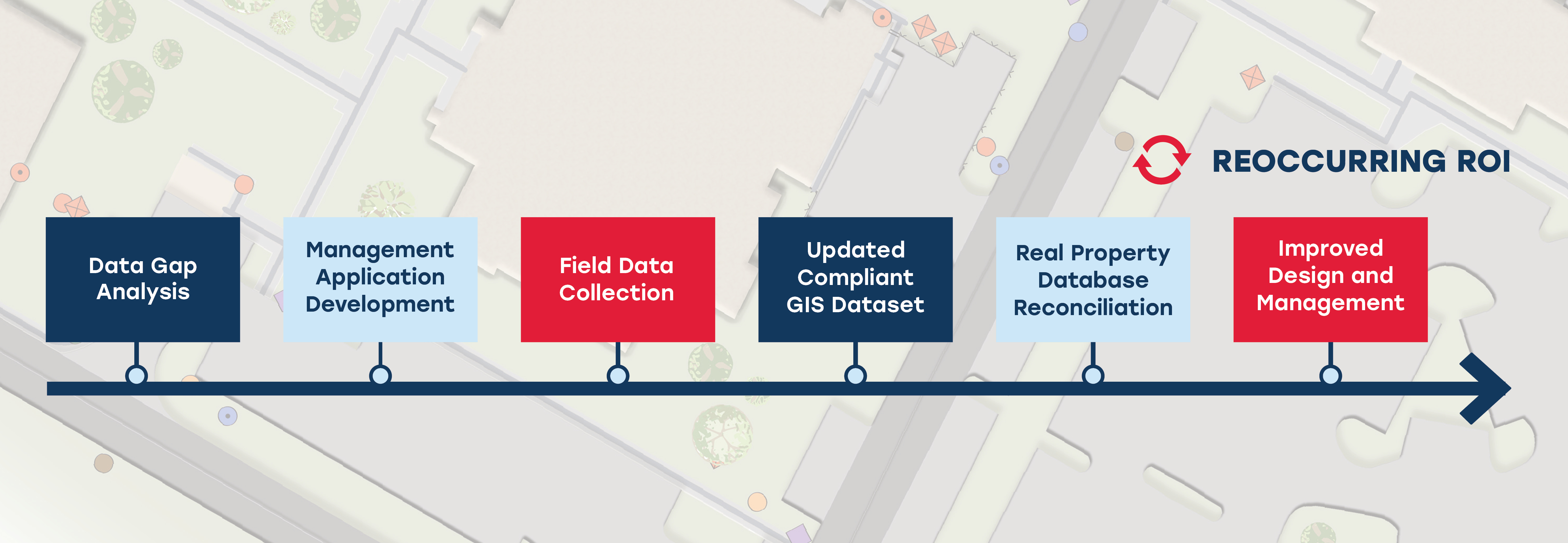
Pond’s solutions are often compliance based. Many of our clients are faced with having to update their datasets to meet a new federally or industry mandated data standard. These initiatives are mostly large-scale projects at state, regional, and municipal levels where GIS data not only has to be put into a compliant set, but also has to be updated to capture an accurate picture of the real property currently in place. The reconciliation of the client’s data not only yields an ROI by providing an accurate footprint for planning, design, and maintenance, but in some cases also provides sustainment funds for real property that clients did not know they had. In these cases, the ROI pays for the GIS project, and continues to do so through elimination of risk to day-to-day client missions.
Case Study: US Army Reserve GIS Data Collection and Development
Pond supported the US Army Reserve’s initiative to inventory, collect and develop infrastructure and facility GIS and building space data with facility and space utilization surveys for optimal planning and management. This effort included developing or standardizing Common Installation Picture GIS layers in the US Army GIS Standard, Spatial Data Standard for Facilities, Infrastructure, and Environment (SDSFIE), and Proactive Real-property Interactive Space Management System (PRISMS) data development to support the USAR’s 81st, 63rd, 88th, 99th Regional Commands and 9th Mission Support Command.
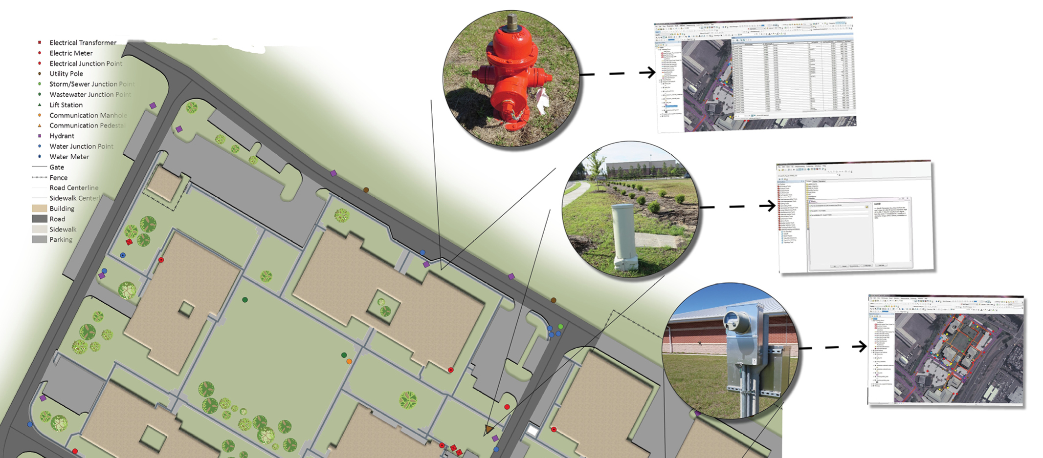
This project ultimately delivered the first complete GIS facilities and infrastructure dataset for facilities management within the DoD SDSFIE GIS standard and ESRI geodatabase format for the Army Reserve and building space standard for USAR sites across the continental United States, Puerto Rico, Alaska, Hawaii, American Samoa, Guam and Saipan. The project included over 600 field site visit locations for GIS/GPS data and floor plan verification for GIS and building system development including the following tasks:
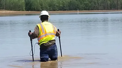
- External Asset Data Collection and Development – Pond developed SDSFIE-compliant GIS layers with virtual base, property boundary, fences, utilities, gates, parking, sidewalks, roads, airfields, power poles, manhole covers, pad & pole mount transformers, lift stations, communication boxes/vaults, meters, maintenance holes, hydrants, and the last highway mile marker post off property. The resulting GIS dataset yielded a real property reconciliation that included the addition of thousands of unclaimed assets, which in turn yields annual savings through better planning, design and management, and an increase in federal sustainment funds.
- Metadata Delivery – The project also delivered updated metadata and highly accurate locations. Pond updated metadata files for all current geospatial data layers and created metadata for all newly created layers in accordance with the latest federal guidelines. All data acquisition was executed with sub-foot GPS technology, and refinement of aerial orthophotography mapping for reconciliation of GPS data gathered in the field.
- Internal Asset Data Collection and Development – In addition to the external assets, Pond developed CADD floor plan data and facility space utilization per Army standard to verify real property data in their real property inventory and to support space utilization planning and facility management. The project developed real property reconciliation reports based on verified plans for the update of real property database facility tabulations, which in turn also developed additional ROI through sustainment funds based on found square footage, and a more accurate baseline for facilities design and management.
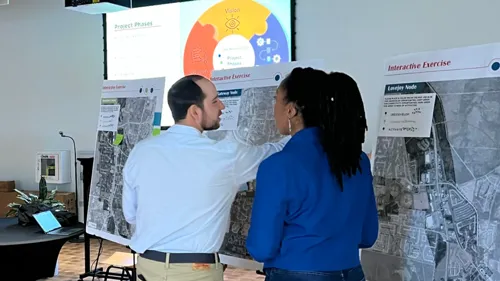
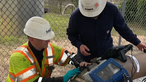
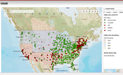
- Web-based Management Application Utilization – The scope required logistics management in a matrix; however, Pond saw an opportunity to maximize collaboration, visibility, and project engagement using a web-based management application (see image above). This tool allowed stakeholders to see project status in real-time via a map of site locations and charts.
Bottom Line
The daily task of managing infrastructure and facilities data can be monumental, and accurate datasets limit risk to daily operations while providing an ROI where the projects help pay for themselves. Pond provides a full-spectrum, peer-to-peer set of geospatial services with a focus on quality, useability, and ROI. Providing solutions in data acquisition, database development, geospatial analysis, cartography, application development, enterprise consulting, and training, Pond helps clients navigate through the challenges of spatial data management and compliance-based initiatives. Our solutions ensure projects are auditable and executable. Learn more about Pond's geospatial capabilities.