
ARC North Fulton Comprehensive Transportation Plan - Fulton County, GA
Pond performed transportation planning and land use coordination as part of the consulting team that produced this Comprehensive Transportation Plan (CTP), led by the Atlanta Regional Commission and Fulton County. This plan combined transportation and land use from the Cities of Sandy Springs, Roswell, Alpharetta, Milton, Mountain Park, and Johns Creek to provide a transportation plan that addresses the needs of each jurisdiction, while serving the region as a whole. Pond assembled information on the travel impacts of various land use factors and density for use in relating potential land use changes to travel reduction. As a part of the North Fulton needs assessment, Pond reviewed zoning ordinances for each city to identify zoning, subdivision, land use, and street design regulations that affect transportation within each of the six municipalities. Access management standards and other recommendations were developed by Pond to affect future transportation infrastructure and land use design.
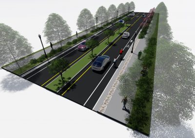
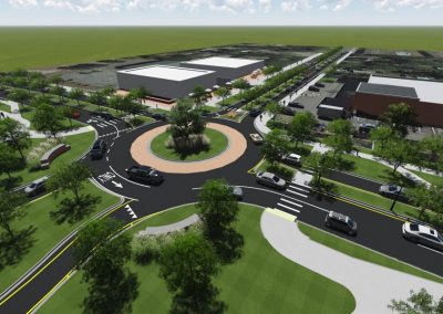
Pond created plans of key nodes that incorporated future land use from the cities, transportation recommendations, and urban design elements. Each plan illustrated the integration of primary elements and types of changes needed to ensure each node is more walkable and transit viable.
Pond produced a GIS mapbook of the study area showing transportation projects recommended as a part of the study, previously recommended transportation projects, and existing transportation infrastructure. Due to the size of the study area, the mapbook shows detailed images of individual, small grid “cells” (or plans). Together, these grid “cells” cover the entire study area. Due to the level of detail, the mapbook can be used as a reference for each municipality, facilitating the incorporation of each transportation recommendation as future development is planned and constructed.
Related Projects
Related News
No Results Found
The page you requested could not be found. Try refining your search, or use the navigation above to locate the post.